Skip to content

Search Term Record

Metadata

Related Records

  1. Map - 1984.020c.0002

    Map - Middle Third of Brazoria County

    Record Type: Archive

    1984.020c.0002  Title Block
  2. Map - 1988.070c.0042

    Map - Blueprint of 1988.070c.0168

    Record Type: Archive

    1988.070c.0042  Title Block
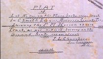
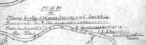
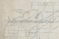
  3. Map - 1988.070c.0043

    Map - Lot No. One in the Mary Scoby 775 tract in Cornelius Smith league

    Record Type: Archive

    1988.070c.0043  Title Block
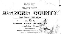
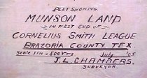
  4. Map - 1988.070c.0069

    Map - Mary Scoby 775 acres survey in C.Smith Lg.Brazoria Co. Tex. & the original subdivisions.

    Record Type: Archive

    1988.070c.0069  Front
  5. Map - 1988.070c.0102

    Map - Munson land in west end of Cornelius Smith league

    Record Type: Archive

    1988.070c.0102  Title Block
  6. Map - 1988.070c.0112

    Map - Blueprint of 1988.070c.0170

    Record Type: Archive

    1988.070c.0112 Title Block
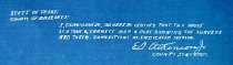
  7. Map - 1988.070c.0116

    Map - Mary Scoby 775 acres survey in C.Smith Lg.Brazoria Co. Tex. & the original subdivisions.

    Record Type: Archive

    1988.070c.0116  Title Block
  8. Map - 1988.070c.0135

    Blueprint

    Record Type: Archive

    1988.070c.0135  Title Block
  9. Map - 1988.070c.0168

    Map - Bailey, Smith, Carter, and Mitchell Leagues

    Record Type: Archive

    1988.070c.0168  Detail - Willow Glen
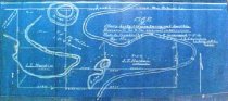
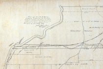
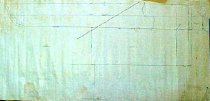
  10. Map - 1988.070c.0169

    Map - Survey of east line of Cornelius Smith league at three different locations

    Record Type: Archive

    1988.070c.0169  Entire Map
  11. Map - 1988.070c.0170

    Map - James B. Bailey & its connections.

    Record Type: Archive

    1988.070c.0171  Detail
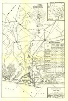
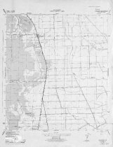
  12. Map - 1989.006c.0033

    Maps - 1943 War Department 7.5-minute maps - Angleton and Rosharon quadrangles

    Record Type: Archive

    1989.006c.0033a  Entire Map
  13. Map - 1995.016c.0002

    Map - Oil lease map of northwest half Brazoria County

    Record Type: Archive

    1995.016c.0002-01  Title Block
  14. Map - 1998.013c.0001

    Map - Oil Leases in Northwest Half of Brazoria County

    Record Type: Archive

    1998.013c.0001  Title Block
  15. Map - 2008.021c.0001

    Map - Oil lease map of northwest half Brazoria County

    Record Type: Archive

    2008.021c.0001  Detail - Columbia
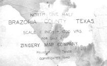
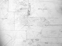
  16. Map - 2009.024c.0015

    Map - East Columbia USGS quadrangle - Title Services Inc. Plat Map

    Record Type: Archive

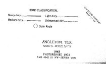
  17. Map - 2009.026c.0003

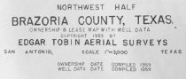
    Map - 1974 USGS 7.5-minute map - Angleton, Texas quadrangle

    Record Type: Archive

    2009.026c.0003  Title Block
  18. Map - 2012.001c.0003

    Map - Freeport Harbor, roads, railroads

    Record Type: Archive

    2012.001c.0003  Entire Map

Thank You!

Confirmation Message Here....