Skip to content

Search Term Record

Metadata

Related Records

  1. Booklet - 1997.004c.0054

    Booklet: Hurricane Warnings. Brief description of hurricanes, hurricane warnings, and hurricane saf

    Record Type: Archive

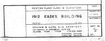
  2. Drawing, Architectural - 2014.015c.0002

    Eades Building - Sweeny - Existing Floor Plans and Elevations

    Record Type: Archive

    2014.015c.0002  Title Block
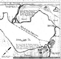
  3. Drawing, Architectural - 2014.015c.0003

    Floor plan of a proposed diorama of Cedar Lake Salt Works

    Record Type: Archive

    2014.015c.0003   Floor plan of Diarama (partial)
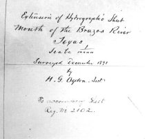
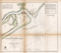
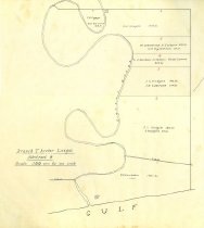
  4. map - 2010.022c.0001

    Map - Entrance to Brazos River - 1858 Two copies in collection

    Record Type: Archive

    2010.022c.0001  Entire Map
  5. Map - 1983.035c.0001

    Map of Quintana

    Record Type: Archive

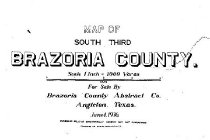
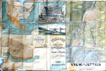
  6. Map - 1983.068c.0001

    Map of old Velasco (now Freeport) published as a promotion of area

    Record Type: Archive

    See 1989.008c.0001  for photos
  7. Map - 1984.020c.0001

    Map - South Third of Brazoria County

    Record Type: Archive

    1984.020c.0001  Title Block
  8. Map - 1988.058c.0001

    Map Texas "Statistical Map of Texas"

    Record Type: Archive

    1988.058c.0001  Title Block
  9. Map - 1988.070c.0054

    Map - C.J. Rogers tract in Brazoria County, Texas.

    Record Type: Archive

    1988.070c.0054 Title Block
  10. Map - 1988.070c.0129

    Map - Parker Williams League Abstract No. 137

    Record Type: Archive

    1988.070c.0129  Title Block
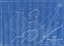
  11. Map - 1988.070c.0208

    Map - San Bernard Oil Co. Property at mouth of San Bernard River

    Record Type: Archive

    1988.070c.0208  Entire Map
  12. Map - 1988.070c.0231

    Map - Branch T. Archer league - Abstract 9

    Record Type: Archive

    Map - Branch T. Archer league - Abstract 9
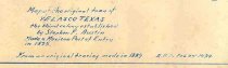
  13. Map - 1989.008c.0001

    Map of old Velasco (now Freeport) published as a promotion of area ("Freeport First and Only").

    Record Type: Archive

    1989.008c.0001  Recto
  14. Map - 1997.028c.0001

    Map - Velasco Townsite 1889

    Record Type: Archive

    1997.028c.0001  Title Block
  15. Map - 2004.002c.0001

    Map - Nautical navigation chart - Central American Waters

    Record Type: Archive

    2004.002c.0001  Title Block
  16. Map - 2007.011c.0001

    1940 Road Map of Brazoria County

    Record Type: Archive

    1940 Brazoria County Road Map
  17. Map - 2007.013c.0001

    Map - Southern Brazoria County Parallel to 288B (1949

    Record Type: Archive

    Map
  18. Map - 2008.010c.0001

    Map - Coast of Texas and Brazos River mouth

    Record Type: Archive

    2008.010c.0001  Entire Map
  19. Map - 2008.010c.0002

    Map - Coast of Texas and Brazos River mouth

    Record Type: Archive

    2008.010c.0002  Title Block
  20. Map - 2008.010c.0003

    Map - Coast of Texas and Brazos River mouth

    Record Type: Archive

    2008.010c.0003  Detail

Thank You!

Confirmation Message Here....