Skip to content

Search Term Record

Metadata

Related Records

  1. map - 2006.026c.0004

    Map - Brazoria TX showing city limits

    Record Type: Archive

    2006.026c.0004  Title Block
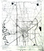
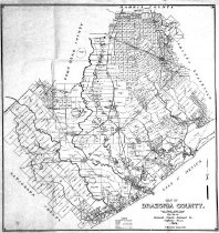
  2. Map - 1988.070c.0057

    Map - Area along "Columbia Road" (now SH35) between Angleton and Bailey's Prairie.

    Record Type: Archive

    1988.070c-0057  North End
  3. Map - 1988.070c.0102

    Map - Munson land in west end of Cornelius Smith league

    Record Type: Archive

    1988.070c.0102  Title Block
  4. Map - 1988.070c.0135

    Blueprint

    Record Type: Archive

    1988.070c.0135  Title Block
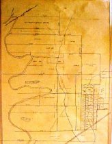
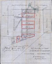
  5. Map - 1988.070c.0174

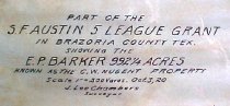
    Map - Subdivisions of the Stephen F. Austin 5-League Grant

    Record Type: Archive

    1988.070c.0174  Title Block
  6. Map - 1988.070c.0213

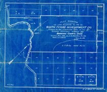
    Map - South Texas Development Co. Cremshaw Tract in the George Harrison League

    Record Type: Archive

    1988.070c.0213  Entire Map
  7. Map - 1988.070c.0240

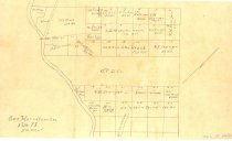
    Map - Subdivisions of the George Harrison League No 51 Abstract 73

    Record Type: Archive

    1988.070c.0240  Entire Map
  8. Map - 1988.070c.0252

    Map - John Hall league, W.D.C. Hall league, Stephen F. Austin leagues

    Record Type: Archive

    1988.070c.0252  Entire Map
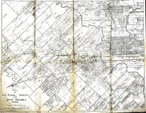
  9. Map - 1989.006c.0033

    Maps - 1943 War Department 7.5-minute maps - Angleton and Rosharon quadrangles

    Record Type: Archive

    1989.006c.0033a  Entire Map
  10. Map - 2009.024c.0003

    Map - Angleton USGS quadrangle - Title Services Inc. Plat Map

    Record Type: Archive

  11. Map - 2009.024c.0015

    Map - East Columbia USGS quadrangle - Title Services Inc. Plat Map

    Record Type: Archive

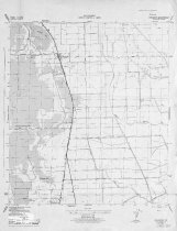
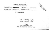
  12. Map - 2009.026c.0003

    Map - 1974 USGS 7.5-minute map - Angleton, Texas quadrangle

    Record Type: Archive

    2009.026c.0003  Title Block
  13. Map - 2010.002c.0133

    Map - N.E. Part of Bryan Sub out of SFA 5-lg grant

    Record Type: Archive

    Map - N.E. Part of Bryan Sub out of SFA 5-lg grant
  14. Map - 2010.019c.0001

    Map -Gulf Oil Corp FISHGUIDE - Freeport

    Record Type: Archive

    2010.019c.0001  Map on recto
  15. Map - 2010.031c.0007

    Map - Brazoria County 1944

    Record Type: Archive

    2010.031c.0007  Entire Map
  16. Map - 2010.031c.0008

    Map - Old Ocean, Sweeny, and West Columbia Areas

    Record Type: Archive

    20010.031c.0008  Entire Map
  17. Map - 2011.025c.0004

    Map - Texas DOT highway map - Brazoria County southwest

    Record Type: Archive

    2011.025c.0004  Entire Map

Thank You!

Confirmation Message Here....