Search Term Record
Metadata
Name |
SH 35 |
Related Records
-

-
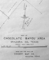
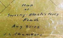
Map - 1988.070c.0057
Map - Area along "Columbia Road" (now SH35) between Angleton and Bailey's Prairie.
Record Type: Archive
-
-
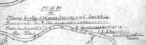
Map - 1988.070c.0069
Map - Mary Scoby 775 acres survey in C.Smith Lg.Brazoria Co. Tex. & the original subdivisions.
Record Type: Archive
-
Map - 1988.070c.0090
Map - Proposed public road along the eastern bank of the Brazos River between East Columbia and Brazoria.
Record Type: Archive

-
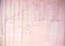
Map - 1988.070c.0101
Map - Property divisions in the Bailey, Smith, Carter, and Mitchell leagues.
Record Type: Archive
-

-
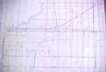
Map - 1988.070c.0116
Map - Mary Scoby 775 acres survey in C.Smith Lg.Brazoria Co. Tex. & the original subdivisions.
Record Type: Archive
-
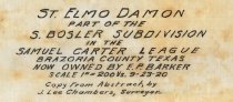
Map - 1988.070c.0125
Map - St. Elmo Damon - Part of the S. Bosler Subdivision in the Samuel Carter League
Record Type: Archive
-
-

-
-
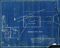
Map - 1988.070c.0152
Map - South Texas Development Company land in Carter League, Bailey League, and Russell Labor.
Record Type: Archive
-
-
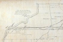
Map - 1988.070c.0169
Map - Survey of east line of Cornelius Smith league at three different locations
Record Type: Archive

-
-
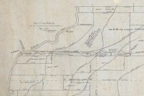
Map - 1988.070c.0172
Map - Subdivisions of James Bailey and Samuel Carter Leagues
Record Type: Archive

-
-
Map - 1997.027c.0003
Map - Lands in Angier Hall & Bradley League - NOT TO SCALE
Record Type: Archive
-
Map - 2008.011c.0001
Map - Area northeast of Liverpool showing oil leases and wells
Record Type: Archive