Skip to content

Search Term Record

Metadata

Related Records

  1. Blueprint - 1984.021c.0007

    Map - Damon Mound Oil Field

    Record Type: Archive

    1984.021c.0007   Title Block
  2. Map - 1984.020c.0002

    Map - Middle Third of Brazoria County

    Record Type: Archive

    1984.020c.0002  Title Block
  3. Map - 1988.070c.0042

    Map - Blueprint of 1988.070c.0168

    Record Type: Archive

    1988.070c.0042  Title Block
  4. Map - 1988.070c.0078

    Map - Subdivision of J. A. Rhodes Estate

    Record Type: Archive

    1988.070c.0078  Title Block
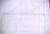
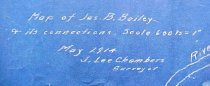
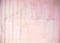
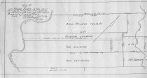
  5. Map - 1988.070c.0101

    Map - Property divisions in the Bailey, Smith, Carter, and Mitchell leagues.

    Record Type: Archive

    088\1988.070c.0101  Entire Map
  6. Map - 1988.070c.0112

    Map - Blueprint of 1988.070c.0170

    Record Type: Archive

    1988.070c.0112 Title Block
  7. Map - 1988.070c.0130

    Map - Study for 1988.070c.0101.

    Record Type: Archive

    1988.070c.0130  Entire Map
  8. Map - 1988.070c.0141

    Map - James B. Bailey League

    Record Type: Archive

    1988.070c.0141 Title Block
  9. Map - 1988.070c.0168

    Map - Bailey, Smith, Carter, and Mitchell Leagues

    Record Type: Archive

    1988.070c.0168  Detail - Willow Glen
  10. Map - 1988.070c.0170

    Map - James B. Bailey & its connections.

    Record Type: Archive

    1988.070c.0171  Detail
  11. Map - 1988.070c.0193

    Map - Columbia (East Columbia and West Columbia)

    Record Type: Archive

    1988.070c.0193 Title Block
  12. Map - 1988.070c.0194

    Map - Columbia (East Columbia and West Columbia)

    Record Type: Archive

    1988.070c.0194  Entire Map
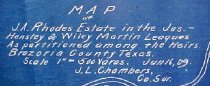
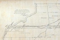
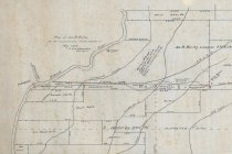
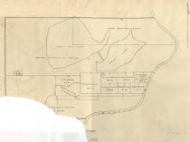
  13. Map - 1988.070c.0210

    Map - J. A. Rhodes Estate in the Jas. Hensley and Wiley Martin leagues

    Record Type: Archive

    1988.070c.0210  West half
  14. Map - 1988.070c.0214

    Map - James Elijah Brown Austin 3 Leagues subdivisions

    Record Type: Archive

    Map - James Elijah Brown Austin 3 Leagues subdivisions
  15. Map - 1995.007c.0001

    Map - East and West Columbia

    Record Type: Archive

    Map - East and West Columbia
  16. Map - 1995.016c.0002

    Map - Oil lease map of northwest half Brazoria County

    Record Type: Archive

    1995.016c.0002-01  Title Block
  17. Map - 1998.013c.0001

    Map - Oil Leases in Northwest Half of Brazoria County

    Record Type: Archive

    1998.013c.0001  Title Block
  18. Map - 2008.021c.0001

    Map - Oil lease map of northwest half Brazoria County

    Record Type: Archive

    2008.021c.0001  Detail - Columbia
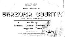
  19. Map - 2009.013c.0002

    Map - 1947 USGS 7.5-minute map - Angleton, Texas quadrangle

    Record Type: Archive

    2009.013c.0002  Title Block
  20. Map - 2009.026c.0035

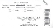
    Map - 1974 USGS 7.5-minute map - West Columbia, Texas quadrangle

    Record Type: Archive

    2009.026c.0035      Title Block

Thank You!

Confirmation Message Here....