Skip to content

Search Term Record

Metadata

Related Records

  1. Badge - 1998.027c.0004

    Dow Freeport ID Badge issued to Rosalie Brewer

    Record Type: Object

  2. Badge - 1998.027c.0005

    Dow Freeport ID badge issued to Rosalie Brewer

    Record Type: Object

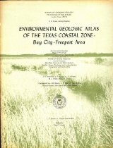
  3. Book with maps - 2014.011c.0001

    Book with maps: Environmental Geologic Atlas of the Texas Coastal Zone Bay City-Freeport Area

    Record Type: Archive

    2014.011c.0001  Front cover of book
  4. Drawing, Architectural - 2011.009c.0008

    Drawings, Architectural - Preliminary Plans for GCBA Seaman's Center, Freeport

    Record Type: Archive

    2011.009c-0008  Shee 1  Title Block
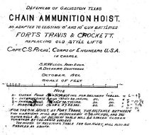
  5. Drawing, Technical - 2009.002c.0001

    Freeport Gun Emplacements - Chain Ammunition Hoist

    Record Type: Archive

    2009.002c.0001       Title Block
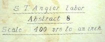
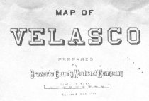
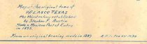
  6. Map - 1983.068c.0001

    Map of old Velasco (now Freeport) published as a promotion of area

    Record Type: Archive

    See 1989.008c.0001  for photos
  7. Map - 1984.020c.0001

    Map - South Third of Brazoria County

    Record Type: Archive

    1984.020c.0001  Title Block
  8. Map - 1988.070c.0241

    Map - Samuel Tubbs Angier Labor Abstract 8

    Record Type: Archive

    1988.070c.0241  Title Block
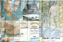
  9. Map - 1989.008c.0001

    Map of old Velasco (now Freeport) published as a promotion of area ("Freeport First and Only").

    Record Type: Archive

    1989.008c.0001  Recto
  10. Map - 1992.008c.0001

    Map - Velasco between Gulf Blvd. and Brazos River

    Record Type: Archive

    1997.008c.0001  Entire Map
  11. Map - 1995.016c.0001

    Map - Velasco in 1951

    Record Type: Archive

    1995.016c.0001  Title Block
  12. Map - 1997.028c.0001

    Map - Velasco Townsite 1889

    Record Type: Archive

    1997.028c.0001  Title Block
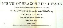
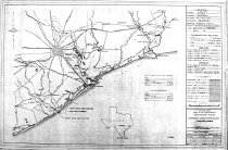
  13. Map - 2001.020c.0002

    Booklet and map - Report of Examination and Survey of Mouth of Brazos River Texas

    Record Type: Archive

    2001.020c.0002  Title Block
  14. Map - 2007.011c.0001

    1940 Road Map of Brazoria County

    Record Type: Archive

    1940 Brazoria County Road Map
  15. Map - 2007.013c.0001

    Map - Southern Brazoria County Parallel to 288B (1949

    Record Type: Archive

    Map
  16. Map - 2008.010c.0009

    Map - U.S.C. & G.S. Map Mouth of Brazos River

    Record Type: Archive

    2008.010c.0009  Title Block
  17. Map - 2008.010c.0017

    Map - Topographic Survey No. 6326

    Record Type: Archive

    2008.010c.0017  Title Blcok
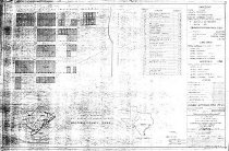
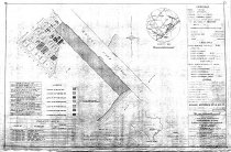
  18. Map - 2009.002c.0005

    Freeport Gun Emplacements - Temporary Harbor Fortification - Freeport Harbor

    Record Type: Archive

    2009.002c.0005  Entire Map
  19. Map - 2009.002c.0006

    Freeport Gun Emplacements - Temporary Harbor Fortification - Freeport Harbor

    Record Type: Archive

    2009.002c.0006  Entire Map
  20. Map - 2009.002c.0007

    Freeport Gun Emplacements - Temporary Harbor Fortification - Freeport Harbor

    Record Type: Archive

    2009.002c.0007 Entire Map

Thank You!

Confirmation Message Here....