Skip to content

Search Term Record

Metadata

Related Records

  1. Brick - 2003.024c.0001

    Red Brick from Ellersly Plantation near Jones Creek

    Record Type: Object

    Red Brick from Ellersly Plantation
  2. Deed - 2010.002c.0041

    Deed for land west of Jones Creek.

    Record Type: Archive

    Cover Page
  3. map - 2006.004c.0001

    Brazoria County Map of Ownership

    Record Type: Archive

    Brazoria County Map of Ownership
  4. Map - 2007.013c.0001

    Map - Southern Brazoria County Parallel to 288B (1949

    Record Type: Archive

    Map
  5. Map - 2008.017c.0001

    Map - Oil Leases in Peach Point Plantation

    Record Type: Archive

    2008.017c.0001  Detail - Central area of map
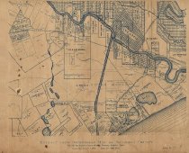
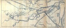
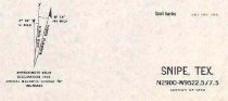
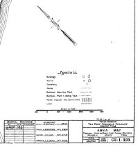
  6. Map - 2008.023c.0001

    Map 1943 - War Department 7.5-minute - Snipe Quadrangle (now Lake Jackson Quad)

    Record Type: Archive

    2008.023c.0001  Title Block
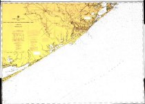
  7. Map - 2009.003c.0001

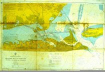
    Map - USCGS Nautical Chart 1283 - San Luis Pass East Matagorda Bay

    Record Type: Archive

    2009.003c.0001  Entire Kap
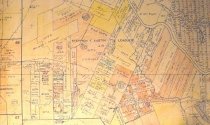
  8. Map - 2009.013c.0004

    Map - 1963 USGS 7.5-minute map - Lake Jackson, Texas quadrangle with proposed highways overwritten

    Record Type: Archive

    2009.013c.0004  Entire Map
  9. Map - 2009.026c.0021

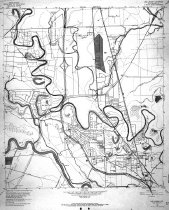
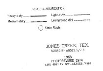
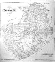
    Map - 1974 USGS 7.5-minute map - Jones Creek, Texas quadrangle

    Record Type: Archive

    2009.026c.0021  Title Block
  10. Map - 2009.026c.0023

    Map - 1974 USGS 7.5-minute map - Lake Jackson, Texas quadrangle

    Record Type: Archive

    2009.026c.0023  Title Block
  11. Map - 2009.029c.0001

    Dow Chemical Company - Area Map

    Record Type: Archive

    2009.029c.0001  Title Block
  12. Map - 2010.014c.0001

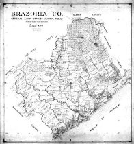
    Map - GLO 1947 of Brazoria County showing original grant boundaries

    Record Type: Archive

    2010.014c.0001  Entire Map
  13. Map - 2010.019c.0002

    Map - USCGS Nautical Charts 886 and 887 (1955)

    Record Type: Archive

    2010.019c.0002   Chart 886 Entire
  14. Map - 2012.001c.0003

    Map - Freeport Harbor, roads, railroads

    Record Type: Archive

    2012.001c.0003  Entire Map
  15. Map - 2013.003c.0035

    Map - Brazoria County, 1879 - W.C.Walsh, Commissioner

    Record Type: Archive

    Brazoria County 1878  W.C.Walsh
  16. Map - 2014.002c.0003

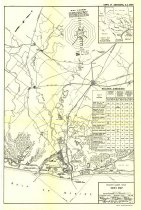
    Map - Brazoria County Road Map Velasco and Dow plants highlighted

    Record Type: Archive

    Title Block
  17. Patch - 2007.016c.0005

    Jones Creek Patch

    Record Type: Object

    Patch
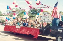
  18. Print, Photographic - 2005.041p.0665

    Stephen F. Austin Girl Scout group/club of Jones Creek on a trailer/float in the Brazoria County Fair Association annual parade

    Record Type: Photo

    SFA girl scouts
  19. Print, Photographic - 2006.021p.0021

    Justice of the Peace, Joe Colter (left) and Brazoria County Sheriff's Dept. deputy, Sgt. David Miles watch as the body of Henry Edward Hancock of Jones Creek is loaded into the hearse, 6/15/1983

    Record Type: Photo

    Drowning victim retrieved
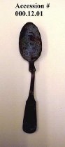
  20. spoon - 2000.012c.0001

    Found near Ellerslie Plantation in the vicinity of Jones Creek. Late 19th early 20th century Euro-American teaspoon. Tin possibly zinc teaspoon

    Record Type: Object

    Late 19th early 20th century Euro-American teaspoon, tin possibly zinc

Thank You!

Confirmation Message Here....