Skip to content

Search Term Record

Metadata

Related Records

  1. Blueprint - 1984.021c.0007

    Map - Damon Mound Oil Field

    Record Type: Archive

    1984.021c.0007   Title Block
  2. Map - 1984.020c.0001

    Map - South Third of Brazoria County

    Record Type: Archive

    1984.020c.0001  Title Block
  3. Map - 1984.020c.0002

    Map - Middle Third of Brazoria County

    Record Type: Archive

    1984.020c.0002  Title Block
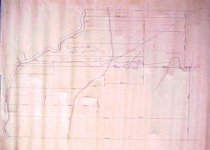
  4. Map - 1988.070c.0013

    Map (two maps on one sheet of paper) Suzzette, Texas (now Bastrop Beach)

    Record Type: Archive

    Survey Map - Richardson et al
  5. Map - 1988.070c.0039

    Map - Drainage District No. 5

    Record Type: Archive

    1988.070c.0039  Title Block
  6. Map - 1988.070c.0042

    Map - Blueprint of 1988.070c.0168

    Record Type: Archive

    1988.070c.0042  Title Block
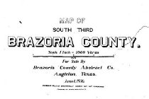
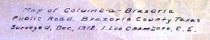
  7. Map - 1988.070c.0057

    Map - Area along "Columbia Road" (now SH35) between Angleton and Bailey's Prairie.

    Record Type: Archive

    1988.070c-0057  North End
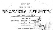
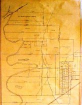
  8. Map - 1988.070c.0076

    Map - subdivision of portions of Richardson, Abbott, and Harris leagues.

    Record Type: Archive

    1988.070c.0076  Entire Map
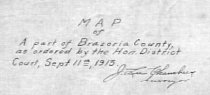
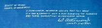
  9. Map - 1988.070c.0077

    Map - Part of Brazoria County as ordered by the Hon. District Court

    Record Type: Archive

    1988.070c.0077  Title Block
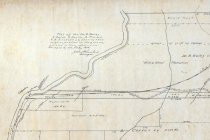
  10. Map - 1988.070c.0090

    Map - Proposed public road along the eastern bank of the Brazos River between East Columbia and Brazoria.

    Record Type: Archive

    1988.070c.0090  Title Block
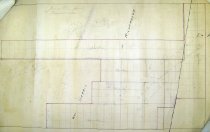
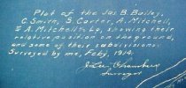
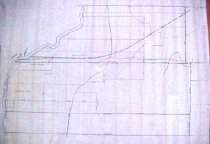
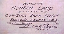
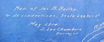
  11. Map - 1988.070c.0101

    Map - Property divisions in the Bailey, Smith, Carter, and Mitchell leagues.

    Record Type: Archive

    088\1988.070c.0101  Entire Map
  12. Map - 1988.070c.0102

    Map - Munson land in west end of Cornelius Smith league

    Record Type: Archive

    1988.070c.0102  Title Block
  13. Map - 1988.070c.0112

    Map - Blueprint of 1988.070c.0170

    Record Type: Archive

    1988.070c.0112 Title Block
  14. Map - 1988.070c.0113

    Map - Sanderson Tract in Andrew Robinson Leauge

    Record Type: Archive

    Map - Sanderson Tract in Andrew Robinson Leauge
  15. Map - 1988.070c.0130

    Map - Study for 1988.070c.0101.

    Record Type: Archive

    1988.070c.0130  Entire Map
  16. Map - 1988.070c.0135

    Blueprint

    Record Type: Archive

    1988.070c.0135  Title Block
  17. Map - 1988.070c.0138

    Map - Drainage District No. 5

    Record Type: Archive

    1988.070c.0037.0138  Title Block
  18. Map - 1988.070c.0141

    Map - James B. Bailey League

    Record Type: Archive

    1988.070c.0141 Title Block
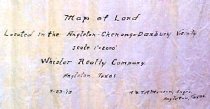
  19. Map - 1988.070c.0159

    Map of Land Located in the Angleton-Chenango-Danbury Vicinity.

    Record Type: Archive

    1988.070c.0159 Title Block
  20. Map - 1988.070c.0168

    Map - Bailey, Smith, Carter, and Mitchell Leagues

    Record Type: Archive

    1988.070c.0168  Detail - Willow Glen

Thank You!

Confirmation Message Here....