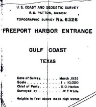
Search Term Record
Metadata
Name |
Freeport Harbor |
Related Records
-
-
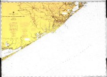
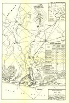
Map - 2009.003c.0001
Map - USCGS Nautical Chart 1283 - San Luis Pass East Matagorda Bay
Record Type: Archive
-
-
-
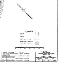
Map - 2014.002c.0003
Map - Brazoria County Road Map Velasco and Dow plants highlighted
Record Type: Archive
-
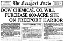
Newspaper - 1995.009c.0001
Newspaper: "The Freeport Facts"; Thurs. March 7, 1940
Record Type: Archive
-
-
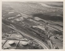
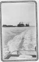
Print, Photographic - 2012.035p.0151
Freeport, Texas Freeport Harbor being dredged, Phillips Petroleum Tank Farm in the foreground.
Record Type: Photo