Skip to content

Search Term Record

Metadata

Related Records

  1. Map - 1984.020c.0002

    Map - Middle Third of Brazoria County

    Record Type: Archive

    1984.020c.0002  Title Block
  2. Map - 1987.049c.0001

    Map and profile of main canal of Osceola Plantation

    Record Type: Archive

    1987.049c..0001   East end of canal
  3. Map - 1988.070c.0093

    Map - James Elijah Brown Austin 3 leagues

    Record Type: Archive

    1988.070c.0093  Title Block
  4. Map - 1988.070c.0214

    Map - James Elijah Brown Austin 3 Leagues subdivisions

    Record Type: Archive

    Map - James Elijah Brown Austin 3 Leagues subdivisions
  5. Map - 1995.016c.0002

    Map - Oil lease map of northwest half Brazoria County

    Record Type: Archive

    1995.016c.0002-01  Title Block
  6. Map - 1998.013c.0001

    Map - Oil Leases in Northwest Half of Brazoria County

    Record Type: Archive

    1998.013c.0001  Title Block
  7. Map - 2008.021c.0001

    Map - Oil lease map of northwest half Brazoria County

    Record Type: Archive

    2008.021c.0001  Detail - Columbia
  8. Map - 2008.034c.0003

    Map - Major Texas Water Resources (Texas Water Development Board)

    Record Type: Archive

    2008.034c.0003  Title Block
  9. Map - 2008.034c.0004

    Map - Major Texas Rivers (Texas Water Development Board)

    Record Type: Archive

    2008.034c.0004  Title Block
  10. Map - 2009.013c.0002

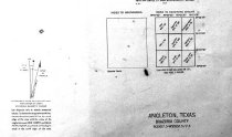
    Map - 1947 USGS 7.5-minute map - Angleton, Texas quadrangle

    Record Type: Archive

    2009.013c.0002  Title Block
  11. Map - 2009.026c.0035

    Map - 1974 USGS 7.5-minute map - West Columbia, Texas quadrangle

    Record Type: Archive

    2009.026c.0035      Title Block
  12. Map - 2010.014c.0001

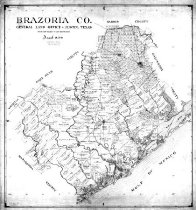
    Map - GLO 1947 of Brazoria County showing original grant boundaries

    Record Type: Archive

    2010.014c.0001  Entire Map
  13. Map - 2012.001c.0004

    Map - Brazoria Watershed Soils

    Record Type: Archive

    2012.001c.0004  Entire map

Thank You!

Confirmation Message Here....