Search Term Record
Metadata
Name |
Cold Pass |
Related Records
-
-
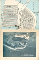
Map - 2009.025c.0001
Plat Map - Treasure Island Section II (now San Luis Island)
Record Type: Archive
-
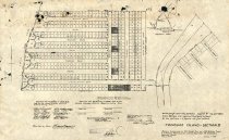
Map - 2009.025c.0001
Plat Map - Treasure Island Section II (now San Luis Island)
Record Type: Archive
-
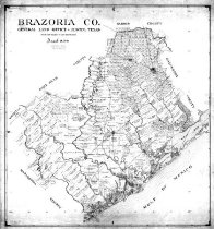
Map - 2010.014c.0001
Map - GLO 1947 of Brazoria County showing original grant boundaries
Record Type: Archive
-
-
-
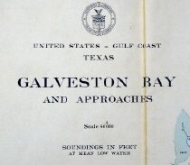
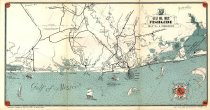
Map - 2010.019c.0003
Map - USCGS Nautical Chart 1282: Galveston Bay and Approaches (1948)
Record Type: Archive

-
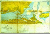
Map - 2010.019c.0004
Map - USCGS Nautical Chart 1282: Galveston Bay and Approaches (1957)
Record Type: Archive