Search Term Record
Metadata
Name |
CR 48 |
Related Records
-
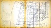
Map - 1988.070c.0075
Map - Subdivisions of part of J. De J. Valderas survey, near Angleton,
Record Type: Archive
-
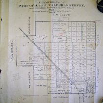
Map - 1988.070c.0134
Map - W.C. Stockton Subdivision of the John W. Cloud Survey
Record Type: Archive
-
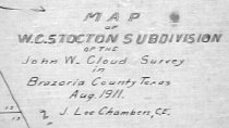
Map - 1988.070c.0159
Map of Land Located in the Angleton-Chenango-Danbury Vicinity.
Record Type: Archive
-
-
-

-
Map - 2009.024c.0002
Map - Almeda USGS quadrangle - Title Services Inc. Plat Map
Record Type: Archive
-
Map - 2009.024c.0030
Map - Rosharon USGS quadrangle - Title Services Inc. Plat Map
Record Type: Archive
-
Map - 2009.024c.0030
Map - Rosharon USGS quadrangle - Title Services Inc. Plat Map
Record Type: Archive
-
-
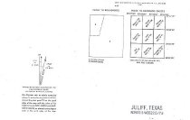
MAP - 2009.024c.0022
Map - Juliff USGS quadrangle - Title Services Inc. Plat Map
Record Type: Archive