Search Term Record
Metadata
Name |
Big Slough |
Related Records
-
-
Map - 1988.070c.0148
Map - Stratton Ridge (subdivisions of the Jared E. Groce League)
Record Type: Archive

-
-
-
Map - 2008.023c.0001
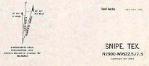
Map 1943 - War Department 7.5-minute - Snipe Quadrangle (now Lake Jackson Quad)
Record Type: Archive
-
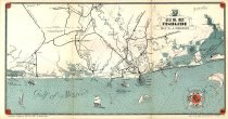
Map - 2009.003c.0001
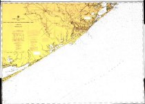
Map - USCGS Nautical Chart 1283 - San Luis Pass East Matagorda Bay
Record Type: Archive
-
Map - 2009.013c.0004
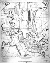
Map - 1963 USGS 7.5-minute map - Lake Jackson, Texas quadrangle with proposed highways overwritten
Record Type: Archive
-
Map - 2009.013c.0013
Map - 1947 USGS 7.5-minute map - Christmas Point quadrangle
Record Type: Archive

-
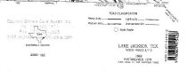
Map - 2009.026c.0023
Map - 1974 USGS 7.5-minute map - Lake Jackson, Texas quadrangle
Record Type: Archive
-