Skip to content

Person Record

Metadata

Related Records

  1. Map - 1988.070c.0042

    Map - Blueprint of 1988.070c.0168

    Record Type: Archive

    1988.070c.0042  Title Block
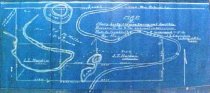
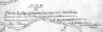
  2. Map - 1988.070c.0043

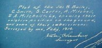
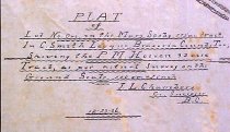
    Map - Lot No. One in the Mary Scoby 775 tract in Cornelius Smith league

    Record Type: Archive

    1988.070c.0043  Title Block
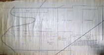
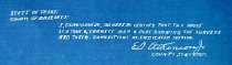
  3. Map - 1988.070c.0045

    Map - East line of the C. Smith league as fixed by Court of Civil Appeals

    Record Type: Archive

    1988.070c.0045
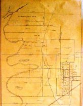
  4. Map - 1988.070c.0046

    Map - Cornelius Smith League & adjoining surveys as located by the Courts

    Record Type: Archive

    1988.070c.0046
  5. Map - 1988.070c.0057

    Map - Area along "Columbia Road" (now SH35) between Angleton and Bailey's Prairie.

    Record Type: Archive

    1988.070c-0057  North End
  6. Map - 1988.070c.0067

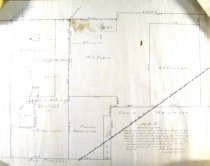
    Map - Subdivision of lands on the east side of Oyster Creek northwest of Angleton.

    Record Type: Archive

    1988.070c.0067  South Half
  7. Map - 1988.070c.0069

    Map - Mary Scoby 775 acres survey in C.Smith Lg.Brazoria Co. Tex. & the original subdivisions.

    Record Type: Archive

    1988.070c.0069  Front
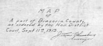
  8. Map - 1988.070c.0077

    Map - Part of Brazoria County as ordered by the Hon. District Court

    Record Type: Archive

    1988.070c.0077  Title Block
  9. Map - 1988.070c.0102

    Map - Munson land in west end of Cornelius Smith league

    Record Type: Archive

    1988.070c.0102  Title Block
  10. Map - 1988.070c.0111

    Map - H.T.&B RR (Sections 1 & 2) and Munson Properties

    Record Type: Archive

    Map - H.T.&B RR (Sections 1 & 2) and Munson Properties
  11. Map - 1988.070c.0112

    Map - Blueprint of 1988.070c.0170

    Record Type: Archive

    1988.070c.0112 Title Block
  12. Map - 1988.070c.0116

    Map - Mary Scoby 775 acres survey in C.Smith Lg.Brazoria Co. Tex. & the original subdivisions.

    Record Type: Archive

    1988.070c.0116  Title Block
  13. Map - 1988.070c.0135

    Blueprint

    Record Type: Archive

    1988.070c.0135  Title Block
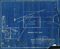
  14. Map - 1988.070c.0152

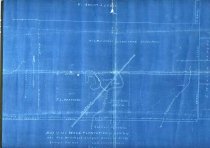
    Map - South Texas Development Company land in Carter League, Bailey League, and Russell Labor.

    Record Type: Archive

    1988.070c.0152  Entire Map
  15. Map - 1988.070c.0168

    Map - Bailey, Smith, Carter, and Mitchell Leagues

    Record Type: Archive

    1988.070c.0168  Detail - Willow Glen
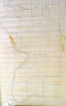
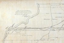
  16. Map - 1988.070c.0169

    Map - Survey of east line of Cornelius Smith league at three different locations

    Record Type: Archive

    1988.070c.0169  Entire Map
  17. Map - 1988.070c.0170

    Map - James B. Bailey & its connections.

    Record Type: Archive

    1988.070c.0171  Detail
  18. Map - 1988.070c.0175

    Map - Subdivisions in Anchor/Angleton Area

    Record Type: Archive

    088\1988.070c.0175  Entire Map
  19. Map - 1988.070c.0181

    Map - Blueprint of 1988.070c.0116

    Record Type: Archive

    1988.070c.0181 Entire Map
  20. Map - 1988.070c.0195

    Ward Plantation with 1/2 of the Asa Mitchell League

    Record Type: Archive

    Ward Plantation with 1/2 of the Asa Mitchell League

Thank You!

Confirmation Message Here....