Search Term Record
Metadata
Name |
State Highway 35 |
Related Records
-
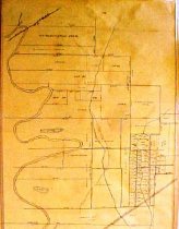
Map - 1988.070c.0057
Map - Area along "Columbia Road" (now SH35) between Angleton and Bailey's Prairie.
Record Type: Archive
-
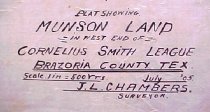
Map - 1988.070c.0069
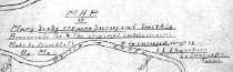
Map - Mary Scoby 775 acres survey in C.Smith Lg.Brazoria Co. Tex. & the original subdivisions.
Record Type: Archive
-
-
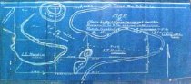
Map - 1988.070c.0116
Map - Mary Scoby 775 acres survey in C.Smith Lg.Brazoria Co. Tex. & the original subdivisions.
Record Type: Archive
-

-
Photograph, digital - 2013.034p.0001
Photos of the Brazos River taken from the Brazos Belle.
Record Type: Photo