Search Term Record
Metadata
Name |
Stratton Ridge |
Related Records
-
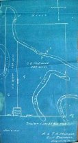
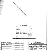
Map - 1988.070c.0148
Map - Stratton Ridge (subdivisions of the Jared E. Groce League)
Record Type: Archive

-
-
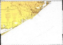
Map - 2009.003c.0001
Map - USCGS Nautical Chart 1283 - San Luis Pass East Matagorda Bay
Record Type: Archive
-
-
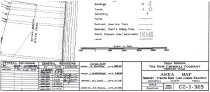
Map - 2014.002c.0003
Map - Brazoria County Road Map Velasco and Dow plants highlighted
Record Type: Archive
-
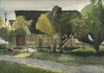
Painting - 2013.011c.0001
Painting on the small brick church that once stood on the corner of C. R. 226 and F. M. Road 523 near Stratton Ridge. Church was destroyed by demolition crews in 2013. Originally the Bethel Presbyterian Church
Record Type: Object
-
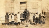
Print, Photographic - 2006.026p.0005
Group of students in front of 1-room Phair School on Stratton Ridge; "x" indicates Estelle Meredith, mother of Max Royalty, on left and ???? on right
Record Type: Photo