Search Term Record
Metadata
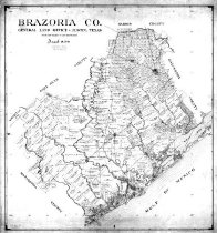
Name |
Fort Bend County Line |
Related Records
-

-
-

-
Map - 2009.024c.0020
Map - Hoskins Mound USGS quadrangle - Title Services Inc. Plat Map
Record Type: Archive
-
-
Map - 2010.014c.0001
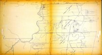
Map - GLO 1947 of Brazoria County showing original grant boundaries
Record Type: Archive