Person Record
Metadata
Name |
Damon, W.W. |
Related Records
-
-
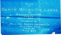
Map - 1988.070c.0064
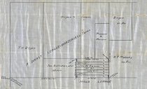
Map - division of the H. L. and T. H. Bryan property in the A. Darst and J. P. Mills surveys
Record Type: Archive
-
Map - 1988.070c.0065
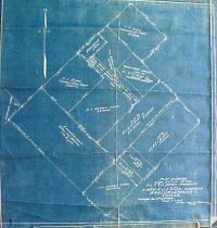
Map - subdivisions of a tract of 12.5 acres of land in Abraham Darst league
Record Type: Archive
-
Map - 1988.070c.0154
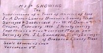
Map - Subdivisions of lands located in the Abraham Darst league west of Community of Damon.
Record Type: Archive