Person Record
Metadata
Name |
Lee, Theodore S. |
Related Records
-
Contract - 2008.048c.0001
Surface lease: Texas Exploration and Production Co. to Texas A&M University System for the benefit of Texas Agricultural Experiment Station #3
Record Type: Archive
-
-
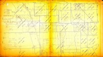
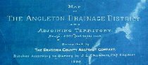
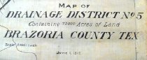
Map - 1988.070c.0053a, b
Map - Angleton Drainage District and Adjoining Territory. Letter - Recommendation of J. Lee Chambers d Letter of Recommendation
Record Type: Archive
-
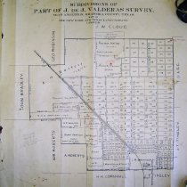
Map - 1988.070c.0075
Map - Subdivisions of part of J. De J. Valderas survey, near Angleton,
Record Type: Archive
-
-
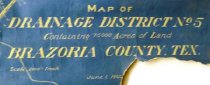
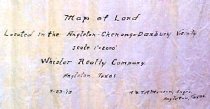
Map - 1988.070c.0159
Map of Land Located in the Angleton-Chenango-Danbury Vicinity.
Record Type: Archive
-

-

-
-
Map - 2009.024c.0003
Map - Angleton USGS quadrangle - Title Services Inc. Plat Map
Record Type: Archive
-
Map - 2009.024c.0030
Map - Rosharon USGS quadrangle - Title Services Inc. Plat Map
Record Type: Archive