
Person Record
Metadata
Name |
Bradley, John |
Related Records
-
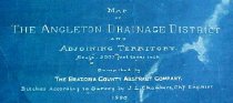
Map - 1988.070c.0053a, b
Map - Angleton Drainage District and Adjoining Territory. Letter - Recommendation of J. Lee Chambers d Letter of Recommendation
Record Type: Archive
-
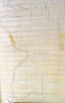
Map - 1988.070c.0067
Map - Subdivision of lands on the east side of Oyster Creek northwest of Angleton.
Record Type: Archive
-
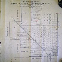
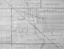
Map - 1988.070c.0075
Map - Subdivisions of part of J. De J. Valderas survey, near Angleton,
Record Type: Archive
-
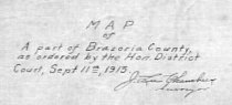
Map - 1988.070c.0077
Map - Part of Brazoria County as ordered by the Hon. District Court
Record Type: Archive
-
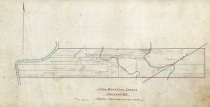
Map - 1988.070c.0153
Map - Leagues between San Bernard River and Matagorda County Line
Record Type: Archive
-

-
-
-

-
Map - 2009.024c.0003
Map - Angleton USGS quadrangle - Title Services Inc. Plat Map
Record Type: Archive