Archive Record
Images

Metadata
Object Name |
Map |
Catalog Number |
1988.070c.0006 |
Title |
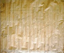
Map - pencil study for 1988.070c.0174 |
Search Terms |
For further description see 1988.070c.0174 |
Scope & Content |
Map Pencil study for 1988.070c.0174 Subdivision of properties owned by W. J. Bryan and Guy M. Bryan With many pencil mathematical notations in margins (apparently acreage calculations) North arrow: no North direction: top of map Compass bearings: yes Scale: not shown Scale unit: vara Apparent scale: 300 varas/inch Prominent features: - Road (historic alignment of FM521) - Meander line at east bank of Brazos River - Unidentified waterway (tributary of Mill Bayou) |
Subjects |
For further description see 1988.070c.0174 |
People |
Bass, Nan Bryan, William Joel Bryan, Guy Morrison Bennett Blow, A[mos] Hawkins Stanger |
Year Range from |
1920 |
Year Range to |
1920 |
Extent of Description |
Paper 23.5" wide x 19.5" high Image 21.0" wide x 18.0" high |
Collection |
Nan Bass |
Accession number |
1988.070c |
Other number |
1988-70-06 |
Source |
Nan Bass |
Credit line |
Nan Bass |
Lexicon category |
8: Communication Artifact |
Catalog type |
Archive |
Condition |
Fair |
Imagefile |
007\1988.070c.0006.jpg |
Number of images |
1 |
